Within UFO Case AI
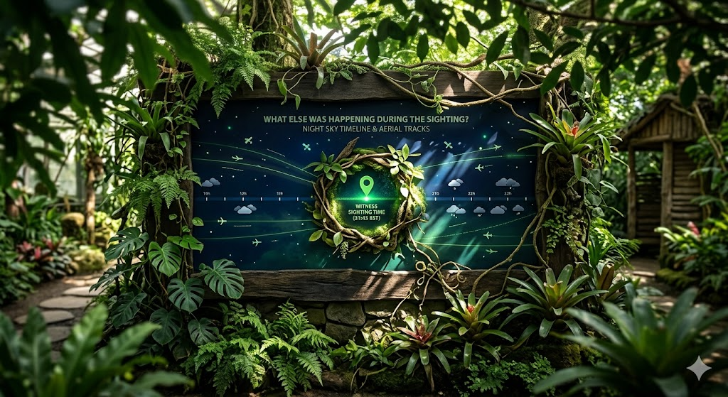
What Else Was Happening During the Sighting?
A sighting timeline shows what was happening in the sky, weather, and local environment before, during, and after the report.
On this page
- Before, during, and after the event
- Layering sky, weather, and local data
- Finding conflicts and missing evidence
Page outline Jump by section
Introduction
AI timeline reconstruction for a single UFO event means rebuilding the minutes and hours around a sighting as one evidence window: what the witness reported, what the camera or sensor recorded, what was in the sky, what the weather was doing, and what local conditions might have shaped perception. It does not make the sighting extraordinary or ordinary by itself. Its value is narrower and more useful: it shows whether the report lines up with aircraft, satellites, balloons, astronomy, weather, sensor artefacts, or something that remains unresolved after those checks.
For an AI-assisted UFO sighting investigation, the timeline is the bridge between a raw story and a testable case file. A light seen at 21:43 is not assessed in isolation. It is compared with aircraft tracks, satellite passes, Moon and planet positions, wind at altitude, visibility, cloud, local power or network incidents, nearby events, and any gaps in the witness account. NASA’s independent UAP study made the same broad point in scientific terms: useful UAP analysis depends on robust data, good metadata, calibrated observations, and systematic reporting rather than isolated anecdotes. [NASA Science]science.nasa.govScience Independent Study Team ReportScience Independent Study Team Report
Before, during, and after the event
A good sighting timeline starts before the witness first noticed the object. That may sound excessive, but many explanations only become visible when the event is widened slightly. A satellite may have entered sunlight a minute before the witness looked up. A helicopter may have turned towards the observer before seeming to hover. A balloon may have drifted with the wind for half an hour before crossing the viewing line. A bright planet may have been present all evening, then become conspicuous when clouds thinned or the witness moved to a darker spot.
The first step is to define the event time window. For a brief phone video, that may mean five minutes before the first frame and five minutes after the last frame. For a longer witness account, it may mean an hour either side. For reports involving launches, re-entries, storms, or multiple witnesses, the window may need to extend further. The important point is that the AI system should not treat the reported start time as absolute truth. It should preserve the original claim, extract any embedded clues, and mark confidence: device timestamp, witness estimate, social media post time, emergency call log, CCTV clock, or later recollection.
A practical reconstruction usually separates the window into three bands:
- Before the sighting: aircraft already inbound, satellites rising into visibility, cloud breaks, weather fronts, launch or re-entry notices, local events, and earlier witness reports.
- During the sighting: object position, motion, brightness, sound, apparent shape, camera movement, sensor mode, weather at the observer’s location, and competing objects in the same patch of sky.
- After the sighting: disappearance mechanism, follow-up sightings, later aircraft or satellite matches, weather changes, media amplification, file edits, and witness revisions.
This structure matters because apparent behaviour is often created by transitions. “It appeared from nowhere” may mean a satellite flared, a plane emerged from cloud, a camera exposure changed, or a bright object became visible against a darker background. “It vanished” may mean it entered shadow, turned away, passed behind cloud, dropped below a roofline, or was lost when autofocus shifted.
A strong AI workflow should therefore create not one timeline but a layered one. The witness timeline records what was experienced. The media timeline records what the file actually shows. The sky timeline records aircraft, satellites, planets, meteors, and launch activity. The environment timeline records weather, visibility, wind, cloud, temperature, precipitation, and local lighting. The analysis timeline records when each explanation became plausible, weak, ruled out, or still unresolved.

The timeline must protect the original report
The main risk in AI-assisted reconstruction is not that the system will be too sceptical. It is that it will quietly rewrite the case. Witnesses use everyday language, not measurement language. “Fast” may mean fast across the field of view, not fast in absolute speed. “Silent” may mean no sound reached the observer, not that the object emitted none. “Above the trees” may mean just over a local roofline, not vertically above the tree canopy.
The system should preserve the witness’s own wording before converting it into structured fields. That allows later reviewers to see the difference between the report and the interpretation. For example, an intake note might retain “a glowing ball shot across the sky”, while the structured layer records “single luminous object; left-to-right apparent motion; duration approximately 12 seconds; no sound reported; elevation unknown; direction uncertain”. The original wording may be emotionally vivid, but the structured version is what can be compared with aircraft, satellites, meteors, and weather.
The strongest timelines also track uncertainty as the event unfolds. If the witness gave “about 10 pm” but the video file was created at 21:48, the AI should not simply overwrite one with the other. It should record both, flag the discrepancy, and ask whether the device clock was accurate. If the video was shared through a messaging app, the system should distinguish original metadata from platform-altered metadata. If a still image lacks location data, it should not infer a precise viewing direction unless buildings, stars, terrain, or other reference points support that inference.
This is where timeline reconstruction differs from a generic UFO database entry. A database may store fields. A timeline shows dependencies: this flight match only works if the timestamp is within two minutes; this satellite explanation only works if the witness was facing west; this balloon explanation depends on wind direction at the relevant altitude; this astronomy explanation fails if the object moved rapidly relative to fixed stars.
Layering sky, weather, and local data
A sighting timeline becomes useful when different kinds of evidence are placed on the same clock. AI can automate much of the gathering, but the point is not to drown the case in data. It is to make each proposed explanation answer the same questions: was it present, was it visible, did it move the right way, did it last the right amount of time, and does it fit what the witness and media actually show?
Aircraft data is often one of the first layers. Open aviation sources can include ADS-B, Mode S, MLAT, ADS-C, FLARM, and VHF-derived data depending on platform and region. OpenSky describes itself as an open air-traffic data source for research, while ADS-B Exchange states that its historical archive has captured aircraft positions and related ADS-B, MLAT, and Mode S parameters worldwide at five-second intervals since March 2020. [OpenSky Network]apify.comOpen Sky NetworkOpen Sky Network Flightradar24 explains the practical limitation: ADS-B broadcasts position, speed, altitude, and identification, while aircraft without full ADS-B may require multilateration, and some aircraft are harder or impossible to track publicly. [Flightradar24]flightradar24.comOpen source on flightradar24.com.
That means an AI timeline should never treat “no aircraft found” as “no aircraft existed”. It should say what was checked, which sources covered the area, whether military or non-cooperative aircraft could be missing, and whether the apparent motion fits an aircraft even without a confirmed track. A low, silent object filmed on a phone near an airport has a different baseline from a high, bright object over open countryside.
Satellite and astronomy layers require a different kind of timing. Satellites may be visible only when they are sunlit while the observer is in darkness. Starlink trains can appear as strings of lights after launch, while satellite flares can brighten and fade in ways that look purposeful to an unaided observer. CelesTrak provides orbital element data used for satellite prediction, Space-Track offers programmatic access to space-object data, and Heavens-Above publishes observer-oriented satellite pass predictions. [2space-track.org]space-track.orgSource details in endnotes. For planets, the Moon, comets, and other solar-system objects, JPL Horizons provides observer-specific ephemerides, so an investigator can calculate where an object appeared from a given place at a given time. [JPL Solar System Dynamics]ssd.jpl.nasa.govJPL Solar System Dynamics NASA Horizons ManualJPL Solar System Dynamics NASA Horizons Manual
Weather is not a background detail; it can determine whether a candidate explanation is physically plausible. Surface wind may not match wind at balloon altitude. Cloud layers may hide aircraft lights but leave planets visible through breaks. Visibility, humidity, haze, precipitation, and temperature inversions can change apparent brightness and distance. NOAA’s National Weather Service API gives access to forecasts, alerts, and observations, NOAA’s past-weather tools support station observation history, and Meteostat provides historical hourly observations for locations or stations while warning that aggregation and gap-filling methods vary by provider. Meteostat Developers [Weather.gov]weather.govSource details in endnotes. [NCEI]ncei.noaa.govNCEIPast WeatherNCEIPast Weather In the UK, the Centre for Environmental Data Analysis catalogue describes MIDAS Open hourly weather observation data from Met Office stations, including wind, cloud, visibility, temperature, and related measurements across a long historical span. [CEDA Catalogue]catalogue.ceda.ac.ukSource details in endnotes.
The AI’s role is to align these layers to the event window and make the comparison explicit. A balloon explanation is stronger if the object drifts with wind direction and speed, weaker if it moves against measured winds, and unresolved if the relevant altitude wind is unknown. A satellite explanation is stronger if the predicted track crosses the witness’s viewing direction at the reported time, weaker if the satellite was below the horizon or in Earth’s shadow, and unresolved if the location or direction is too vague.
What AI can add that a manual timeline often misses
Manual investigators can reconstruct timelines, but they often do it unevenly. They may check aircraft and forget upper-level winds, or check planets but not satellite flares, or trust the video timestamp without asking whether the file is original. AI is useful because it can apply the same sequence of checks to every case and keep a record of what changed the assessment.
One high-value use is time normalisation. Witnesses may report local time, UTC, daylight-saving time, social media posting time, or a camera clock set to the wrong zone. A timeline tool can convert everything into a common time base while displaying the original values. That matters when comparing a UK summer sighting in British Summer Time with satellite predictions in UTC, or when matching a phone video to a flight database with timestamps in a different standard.
Another use is candidate generation. Given a location, time, and rough viewing direction, the system can retrieve likely aircraft tracks, satellite passes, planets, the Moon, meteor shower activity, weather observations, and local events. It can then rank candidates by fit rather than by popularity. A slow light near the western horizon at dusk might bring Venus, aircraft approach paths, and Starlink flares to the top. A cluster of drifting thermal spots in infrared might elevate balloons or birds. A short bright streak might point first to a meteor, re-entry fragment, or camera artefact.
AI can also expose timeline conflicts. If the witness says the object moved north to south but the only nearby aircraft moved east to west, the system can flag the mismatch instead of forcing a match. If the video appears to last 18 seconds but the witness remembers “five minutes”, the timeline can treat the video as a captured segment rather than the whole event. If the object seems to accelerate only when the camera pans, the system can mark camera motion as a possible contributor rather than object motion.
Finally, AI can create reviewable explanation paths. Instead of returning “likely balloon”, it can show why: matching drift direction, apparent speed consistent with wind, no independent propulsion, shape consistent with balloon imagery, no sound, and no conflicting aircraft or satellite match. AARO’s public case material shows why this matters. Several official cases from Europe in 2022 were resolved as balloons because the objects’ morphology and performance characteristics aligned with lighter-than-air objects drifting at wind speed and direction. [AARO]aaro.milOfficial UAP ImageryOfficial UAP Imagery The reasoning is not simply “it looked like a balloon”; it is a timeline and behaviour comparison.
A concrete example: when reconstruction changes the case
The best public examples of timeline reconstruction are not always spectacular; they are cases where ordinary explanations become clearer after motion, wind, and sensor context are aligned. AARO’s Puerto Rico case resolution is a useful example because the original 2013 infrared footage from a U.S. Customs and Border Protection aircraft had long been discussed as unusual. AARO later assessed with high confidence that the objects did not demonstrate anomalous speeds or flight behaviour. Its reconstruction considered object motion, wind, and alternative explanations, including the assessment that the objects moved in a straight line at wind speed over land. [AARO]aaro.milOpen source on aaro.mil.
That kind of analysis is directly relevant to AI timeline reconstruction. A raw video can make an object appear fast because the camera platform is moving, the field of view is narrow, the background is distant, or the observer lacks a reliable distance estimate. A timeline that includes sensor position, aircraft motion, object bearing, wind, and terrain can turn a dramatic impression into a testable motion model.
The opposite outcome is also possible. AARO’s public imagery page includes unresolved reports where the footage depicts a possible physical object but the available data is insufficient to determine performance characteristics or even whether a heat signature reflects a physical source, environmental heat differential, or sensor display issue. [AARO]aaro.milPuerto Rico UAP Case ResolutionPuerto Rico UAP Case Resolution For public-facing investigation, that is an important category. The correct result is not always “identified”. Sometimes the best timeline exposes that the evidence is too thin to support either an extraordinary claim or a confident mundane explanation.
This distinction is central to balanced UFO analysis. A case can be unresolved because it is genuinely puzzling, but it can also be unresolved because the time, location, direction, sensor settings, weather, or comparison data are missing. AI should help readers see which kind of unresolved case they are looking at.

Finding conflicts and missing evidence
The most useful part of a timeline is often the gap list. A sighting may feel rich because it has a vivid story, a short video, and multiple comments online, but still be weak as evidence. AI can identify what is absent without dismissing the witness.
Common missing elements include:
- Precise time: “last night” is not enough for satellites, aircraft, planets, or launches.
- Observer location: a town name may be too broad if the viewing direction changes by neighbourhood.
- Viewing direction and elevation: “over the hills” is less useful than “west-north-west, about 20 degrees above the horizon”.
- Original media: reposted clips often lose metadata, compression history, and creation time.
- Camera context: zoom level, exposure, stabilisation, frame rate, autofocus, and whether the camera was moving.
- Weather at the right height: surface wind may not explain a high balloon or cloud-layer movement.
- Independent witnesses: multiple people in the same place are less useful than separated observers with different angles.
- Negative checks: a report should record what was searched and not found, not only the explanation favoured at the end.
Conflicts are just as important as gaps. A claimed “stationary” object may drift relative to stars in the footage. A “silent aircraft” explanation may be weak if the object was close and low, but still plausible if it was distant, high, or masked by wind and traffic noise. A “drone” explanation may fit manoeuvring but fail if the duration, altitude, weather, and distance exceed ordinary consumer-drone performance. A “planet” explanation may fit position and brightness but fail if the object crossed the sky quickly.
The AI system should make these conflicts visible in plain language. It should not bury them inside a confidence score. A score can help triage cases, but a reader needs to know the reason: “aircraft match plausible but unconfirmed because the track passes within the viewing cone three minutes after the reported time”; “satellite explanation weak because predicted passes were below the horizon”; “balloon explanation plausible but altitude winds unavailable”; “camera artefact possible because motion begins when digital zoom and autofocus change”.
Why timing precision changes the explanation
A few minutes can change a UFO case. Satellite passes are time-sensitive. Aircraft positions move rapidly. Meteors last seconds. Launch plumes evolve over minutes. Clouds can reveal and conceal objects. A witness’s estimate may be good enough for a general narrative but not enough for identification.
This is why AI-assisted timelines should assign confidence to time sources. A device timestamp from an original file is stronger than a social media upload time. A 999 or 101 call log, security camera timestamp, dashcam file, aircraft sensor timestamp, or astronomy camera capture can strengthen the event window, but only if the clock is known to be accurate. A phone set to the wrong time zone can mislead an entire reconstruction.
The timeline should also handle duration carefully. Witness duration and recorded duration are different fields. A person may watch an object for several minutes but record only the final 12 seconds. Conversely, a video may be longer than the actual sighting if it includes searching the sky before or after the object appears. AI can mark the observed interval, recorded interval, claimed interval, and analysed interval separately.
This prevents a common error: rejecting a match because the durations do not line up when the witness may have seen only part of the candidate’s path, or accepting a match because the time fits while the direction and behaviour do not. The timeline should require a candidate explanation to fit several dimensions at once: time, position, motion, appearance, duration, and environmental conditions.
Where automation should stay cautious
AI can retrieve data quickly, but it cannot remove the need for judgement. Public aviation feeds may omit aircraft. Satellite predictions depend on orbital data age and observer geometry. Weather stations may be distant from the witness. Reanalysis data may smooth out local conditions. Social media timestamps may reflect upload rather than capture. Camera metadata may be stripped or altered. Witness memory may be sincere but imprecise.
NASA’s UAP study warned that many existing observations are limited by poor calibration, missing metadata, and weak baselines; those are timeline problems as much as data problems. [NASA Science]science.nasa.govScience Independent Study Team ReportScience Independent Study Team Report AARO’s historical reporting has made a similar practical point: many cases remain difficult to resolve because the available data is insufficient or of poor quality, while better data would likely allow more cases to be identified as ordinary objects or phenomena. [U.S. Department of War]media.defense.govDOPSR 2024 0263 AARO HISTORICAL RECORD REPORT VOLUME 1 2024DOPSR 2024 0263 AARO HISTORICAL RECORD REPORT VOLUME 1 2024
The best AI systems should therefore use cautious status labels. “Ruled out” should require a clear contradiction. “Plausible” should mean a candidate fits several key features but lacks full confirmation. “Weak” should mean it fits only one or two features. “Unresolved” should mean the evidence is not enough to decide. “Anomalous” should be reserved for cases where the data are strong and ordinary explanations have been tested and found inadequate, not simply where the story is strange.
That restraint protects both sceptical and open-minded readers. It avoids turning every gap into a mystery and every resemblance into a debunking. A timeline is not a verdict machine. It is a way to show exactly how far the evidence can responsibly go.

What a reconstructed event window should contain
A useful AI-generated timeline for a single UFO event should be readable by a non-specialist and auditable by a careful investigator. It should show the event as a sequence, not a pile of disconnected checks. The following structure works well for a public case page:
- Case anchor: date, local time, time zone, location, observer position, viewing direction, duration, and original report wording.
- Media anchor: file type, creation time, visible object interval, metadata status, camera motion, zoom, frame rate, and any edits or reposts.
- Sky anchor: aircraft tracks, satellite passes, visible planets, Moon position, meteor or re-entry context, launch activity, and uncertainty in each match.
- Weather anchor: surface conditions, cloud, visibility, wind direction and speed, upper-air wind where relevant, precipitation, haze, and lighting conditions.
- Local anchor: terrain, buildings, airports, drone zones, events, emergency incidents, power or network anomalies, and possible ground-based light sources.
- Conflict log: details that do not fit each candidate explanation.
- Missing-evidence log: data that would materially change the assessment.
- Status: ruled out, plausible, weak, unresolved, or anomalous, with reasons rather than only a label.
The format should be compact but not reductive. A timeline entry saying “21:43: aircraft nearby” is less useful than “21:43: aircraft track passes south-west of observer, moving left-to-right relative to reported view; altitude and bearing fit roughly, but no sound reported and object brightness cannot be confirmed from available data.” The second version shows why the match matters and where it may fail.
The real payoff: fewer mysteries, better unresolved cases
The purpose of AI timeline reconstruction is not to make UFO reports less interesting. It is to make them more honestly interesting. Many sightings become less mysterious when the surrounding sky is reconstructed: aircraft turns, Starlink trains, satellite flares, balloons drifting with wind, bright planets, meteors, cloud breaks, and camera behaviour explain a large share of reports. That is useful because it lets investigators spend less time on weak mysteries.
At the same time, a disciplined timeline can make a genuinely unresolved case stronger. If the time is precise, the location is fixed, the camera file is original, weather and sky checks are documented, aircraft and satellite candidates are tested, and the object still does not fit ordinary explanations, the unresolved status means more than it would in a vague report. It becomes a clear statement about evidence, not a substitute for evidence.
For a single UFO event, the central question is not “what was it?” asked in isolation. It is “what else was happening during the sighting, and does any of it explain the report?” AI can help answer that question quickly, consistently, and transparently — provided the timeline keeps confirmed data, witness claims, analyst inferences, and unresolved uncertainty separate.
Endnotes
-
Source: science.nasa.gov
Title: Science Independent Study Team Report
Link: https://science.nasa.gov/wp-content/uploads/2023/09/uap-independent-study-team-final-report.pdf -
Source: nasa.gov
Title: update nasa shares uap independent study report names director
Link: https://www.nasa.gov/news-release/update-nasa-shares-uap-independent-study-report-names-director/ -
Source: opensky-network.org
Link: https://opensky-network.org/ -
Source: flightradar24.com
Link: https://www.flightradar24.com/how-it-works -
Source: flightradar24.com
Link: https://www.flightradar24.com/how-it-works/mlat -
Source: celestrak.org
Link: https://www.celestrak.org/NORAD/elements/ -
Source: space-track.org
Link: https://www.space-track.org/documentation -
Source: heavens-above.com
Link: https://www.heavens-above.com/ -
Source: ssd.jpl.nasa.gov
Title: JPL Solar System Dynamics NASA Horizons Manual
Link: https://ssd.jpl.nasa.gov/horizons/manual.html -
Source: ssd-api.jpl.nasa.gov
Title: Horizon API
Link: https://ssd-api.jpl.nasa.gov/doc/horizons.html -
Source: weather.gov
Link: https://www.weather.gov/documentation/services-web-api -
Source: ncei.noaa.gov
Title: NCEIPast Weather
Link: https://www.ncei.noaa.gov/access/past-weather/ -
Source: dev.meteostat.net
Link: https://dev.meteostat.net/api/point -
Source: dev.meteostat.net
Link: https://dev.meteostat.net/quality.html -
Source: aaro.mil
Title: Official UAP Imagery
Link: https://www.aaro.mil/UAP-Cases/Official-UAP-Imagery/ -
Source: aaro.mil
Link: https://www.aaro.mil/UAP-Cases/UAP-Case-Resolution-Reports/ -
Source: aaro.mil
Title: Puerto Rico UAP Case Resolution
Link: https://www.aaro.mil/Portals/136/PDFs/case_resolution_reports/AARO_Puerto_Rico_UAP_Case_Resolution.pdf -
Source: science.nasa.gov
Link: https://science.nasa.gov/uap/ -
Source: opensky-network.org
Link: https://opensky-network.org/data/scientific -
Source: opensky-network.org
Link: https://opensky-network.org/about/faq -
Source: opensky-network.org
Link: https://opensky-network.org/data -
Source: wow.metoffice.gov.uk
Title: metoffice.gov.uk Met Office WOW
Link: https://wow.metoffice.gov.uk/ -
Source: wow.metoffice.gov.uk
Link: https://wow.metoffice.gov.uk/support -
Source: metoffice.gov.uk
Link: https://www.metoffice.gov.uk/services/data/datapoint/uk-observations-detailed-documentation -
Source: aaro.mil
Link: https://www.aaro.mil/ -
Source: aaro.mil
Title: Congressional Press Products
Link: https://www.aaro.mil/Congressional-Press-Products/ -
Source: aaro.mil
Title: AARO Satellite Flaring Paper 508 FINAL 04222025
Link: https://www.aaro.mil/Portals/136/PDFs/Information%20Papers/AARO_Satellite_Flaring_Paper_508_FINAL_04222025.pdf -
Source: meteostat.net
Link: https://meteostat.net/ -
Source: dev.meteostat.net
Link: https://dev.meteostat.net/api/stations/hourly.html -
Source: dev.meteostat.net
Link: https://dev.meteostat.net/python -
Source: dev.meteostat.net
Link: https://dev.meteostat.net/api -
Source: ssd.jpl.nasa.gov
Link: https://ssd.jpl.nasa.gov/horizons/news.html -
Source: ssd.jpl.nasa.gov
Link: https://ssd.jpl.nasa.gov/horizons/tutorial.html -
Source: ssd.jpl.nasa.gov
Link: https://ssd.jpl.nasa.gov/api/horizons.api?APPARENT=%27AIRLESS%27+&CENTER=%27M39%40399%27+&COMMAND=%27DES%3D20415029%27+&ELEV_CUT=%270%27+&EPHEM_TYPE=%27OBSERVER%27+&MAKE_EPHEM=%27YES%27+&OBJ_DATA=%27YES%27+&QUANTITIES=%271%2C4%2C9%2C20%2C23%2C24%2C29%2C47%2C48%27+&SKIP_DAYLT=%27YES%27&START_TIME=%272024-06-25+UT%27+&STEP_SIZE=%271+HOURS%27+&STOP_TIME=%272024-07-02%27+&format=text -
Source: ssd.jpl.nasa.gov
Link: https://ssd.jpl.nasa.gov/api/horizons.api?CENTER=%27coord%40399%27&COMMAND=%27199%27&COORD_TYPE=%27GEODETIC%27&EPHEM_TYPE=%27OBSERVER%27&MAKE_EPHEM=%27YES%27&OBJ_DATA=%27NO%27&QUANTITIES=%274%2C9%27&SITE_COORD=%27-2.5852%2C49.4383%2C0%27&START_TIME=%272026-04-20%3A30%27&STEP_SIZE=%2710m%27&STOP_TIME=%272026-04-20%3A30%27&TIME_TYPE=%27UT%27&format=text -
Source: noaa.gov
Title: weather observations
Link: https://www.noaa.gov/education/resource-collections/weather-atmosphere/weather-observations -
Source: ncei.noaa.gov
Link: https://www.ncei.noaa.gov/access/homr/ -
Source: noaa.gov
Title: weather and climate resources
Link: https://www.noaa.gov/tools-and-resources/weather-and-climate-resources -
Source: celestrak.org
Link: https://www.celestrak.org/NORAD/documentation/gp-data-formats.php -
Source: war.gov
Title: department of defense releases the annual report on unidentified anomalous phen
Link: https://www.war.gov/News/Releases/Release/Article/3964824/department-of-defense-releases-the-annual-report-on-unidentified-anomalous-phen/ -
Source: flightradar24.com
Title: how flightradar24 uses mlat to counter gps jamming
Link: https://www.flightradar24.com/blog/aviation-explainer-series/how-flightradar24-uses-mlat-to-counter-gps-jamming/ -
Source: flightradar24.com
Title: how we track flights with ads b
Link: https://www.flightradar24.com/blog/inside-flightradar24/how-we-track-flights-with-ads-b/ -
Source: space.com
Title: x starlink satellites
Link: https://www.space.com/spacex-starlink-satellites.html -
Source: space.com
Title: spotting ufos sky hub surveillance
Link: https://www.space.com/spotting-ufos-sky-hub-surveillance -
Source: developer.weather.com
Title: time series observations current hours past 24 0 0
Link: https://developer.weather.com/docs/openapi/time-series-observations-current-hours-past-24-0-0 -
Source: data.gov.uk
Title: historical station observations
Link: https://www.data.gov.uk/dataset/190cc73f-4047-44c8-88f8-5281e6266f7f/historical-station-observations -
Source: catalogue.ceda.ac.uk
Link: https://catalogue.ceda.ac.uk/uuid/c9663d0c525f4b0698f1ec4beae3688e/ -
Source: media.defense.gov
Title: DOPSR 2024 0263 AARO HISTORICAL RECORD REPORT VOLUME 1 2024
Link: https://media.defense.gov/2024/Mar/08/2003409233/-1/-1/0/DOPSR-2024-0263-AARO-HISTORICAL-RECORD-REPORT-VOLUME-1-2024.PDF -
Source: dvidshub.net
Link: https://www.dvidshub.net/video/989430/pr-015-unresolved-uap-report-europe-2022 -
Source: dvidshub.net
Link: https://www.dvidshub.net/video/992262/pr-013-unresolved-uap-report-europe-2022 -
Source: dvidshub.net
Link: https://www.dvidshub.net/video/988675/pr-017-unresolved-uap-report-europe-2024 -
Source: openskynetwork.github.io
Link: https://openskynetwork.github.io/opensky-api/ -
Source: Wikipedia
Link: https://en.wikipedia.org/wiki/Flightradar24 -
Source: keeptrack.space
Link: https://keeptrack.space/resources/celestrak -
Source: linkedin.com
Link: https://www.linkedin.com/posts/flightradar24-ab_flightradar24-activity-7188824159567720448-s1qa -
Source: apify.com
Title: Open Sky Network
Link: https://apify.com/parseforge/opensky-network-scraper/api/openapi
Additional References
-
Source: arxiv.org
Link: https://arxiv.org/html/2505.06254v1 -
Source: arxiv.org
Link: https://arxiv.org/html/2312.00558v3 -
Source: aviationweather.gov
Link: https://aviationweather.gov/data/api/ -
Source: youtube.com
Title: Identifying UAPs: Data, Methods, and Scientific Re-evaluation
Link: https://www.youtube.com/watch?v=k5yqQ-L865ESource snippet
Applying the Scientific Method to Anomalous Phenomena...
-
Source: youtube.com
Title: Using Data Fusion and AI to Evaluate Sky Anomalies
Link: https://www.youtube.com/watch?v=9jD3O3mP-hUSource snippet
Distinguishing Between Known Objects and Unexplained Sightings...
-
Source: youtube.com
Title: Applying the Scientific Method to Anomalous Phenomena
Link: https://www.youtube.com/watch?v=6P6v6d6b634Source snippet
Using Data Fusion and AI to Evaluate Sky Anomalies...
-
Source: thebaldgeek.github.io
Link: https://thebaldgeek.github.io/autoTLE.html -
Source: facebook.com
Link: https://www.facebook.com/wired/posts/new-a-report-released-today-by-nasas-independent-study-team-describes-how-the-ag/695732782422317/ -
Source: aui.edu
Link: https://aui.edu/aaro-releases-report-on-unidentified-anomalous-phenomena-uap/ -
Source: reddit.com
Link: https://www.reddit.com/r/UFOs/comments/1mkuvbq/aaro_releases_two_new_unresolved_videos_of/
Amazon book picks
Further Reading
Books and field guides related to What Else Was Happening During the Sighting?. Use these as the next step if you want deeper reading beyond the article.
The Demon-Haunted World
Supports evidence sequencing, source checking, and avoiding weak inferences.
eBay marketplace picks
Marketplace Samples
Example marketplace items related to this page. Use the search link to explore similar finds on eBay.


![Listing image for UFO PHOTO [MICHAEL SCHENKER] 1970`S TOUR BLACK WHITE IMAGE HEAVY METAL ROCK GEM](/assets/images/marketplace-covers/4d004612d84842389376.jpg)

Topic Tree
Follow this branch
Parent topic
UFO Case AIRelated pages 9
- Aircraft
- Astronomy
- Case File
- Case Match
- Confidence
- Review
- Satellites
- Video Limits
- +1 more in sidebar