Within Tracker gaps
Why Low Aircraft Sometimes Vanish From Tracking Maps
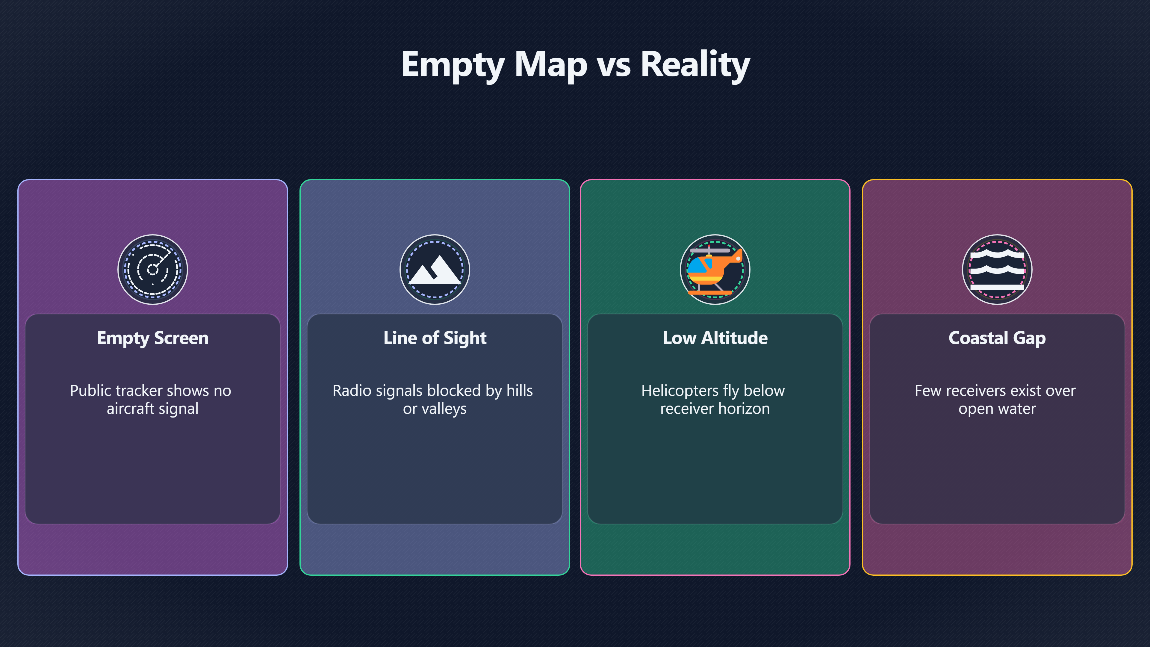
Terrain, coastlines and weak receiver networks can make ordinary helicopters and light aircraft disappear from public maps.
On this page
- Receiver blind spots and terrain masking
- Helicopters and fragmented low altitude tracks
- Reconstructing missing segments with geometry
Page outline Jump by section
Introduction
A low-flying aircraft can vanish from a public tracking map even when it is broadcasting normally. In UFO investigations, this is one of the most important reasons not to treat an empty flight-tracker screen as proof that no aircraft was present. Public tracking services depend on networks of ground receivers, and those receivers only work when they have a usable line of sight to the aircraft. Hills, valleys, cliffs, forests, urban skylines and even the curvature of the Earth can interrupt reception at surprisingly short distances. [Federal Aviation Administration]faa.govFederal Aviation AdministrationADS-B FAQ3 Mar 2025 — In general, the range would depend on your aircraft's altitude and any terrain that… [2Flightradar24 Support center]support.fr24.com3000115347 what is the coverage area of an ads b receiverHowever, coverage can extend up to 400 km (about 250…Read more…
 This matters especially for helicopters, police aircraft, air ambulances, coastguard flights and light aircraft operating below a few thousand feet. Witnesses often report these aircraft as unusually silent, hovering, suddenly accelerating or “disappearing”, particularly at night or over uneven terrain. When the matching track is fragmented or absent from a public map, the sighting can appear more mysterious than it really is. A careful AI-assisted UFO investigation therefore needs to examine tracking coverage quality, local geography and probable flight geometry before concluding that the airspace was empty.
Receiver Blind Spots And Terrain Masking
ADS-B and similar tracking systems are fundamentally radio systems. Most public aircraft maps rely on signals being picked up by volunteers or commercial ground receivers. Those signals travel mainly by line of sight. If terrain blocks the path between aircraft and receiver, the track may vanish. Federal Aviation Administration [Airservices]airservicesaustralia.comFAQ ADS-BBear in mind when operating below the ADS-B coverage, which is limited to “line of sight” between aircraft and ADS-B ground rece…
At cruising altitude, this is less of a problem because airliners are high enough to “see” many receivers at once. A helicopter following a river valley at 400 feet is a different situation entirely. Even modest ridgelines can obstruct reception. A coastline can create the same effect because there may be few receivers offshore. Rural areas often have sparse receiver coverage compared with cities and airports. [Flightradar24 Support center]support.fr24.com3000115347 what is the coverage area of an ads b receiverHowever, coverage can extend up to 400 km (about 250…Read more… [2Flightradar24]
The geometry is easy to underestimate. A receiver mounted on a suburban rooftop may track aircraft hundreds of kilometres away at high altitude, yet lose a helicopter only a short distance beyond a hill. Researchers examining ADS-B collection in US national parks found that terrain shielding and building obstruction significantly affected aircraft signal capture. [ScienceDirect]sciencedirect.comFig. 3…Read more…
This produces a common UFO-investigation mistake: assuming that a public tracker’s clean map reflects complete surveillance coverage. In reality, coverage is highly uneven. A sighting above central London and a sighting in a coastal valley in Wales may have completely different tracking reliability even if both use the same app.
Why Low Altitude Changes Everything
Low altitude dramatically reduces radio horizon distance. The lower the aircraft, the less area its transmissions can physically reach before terrain or Earth curvature intervene. Aviation guidance from the FAA notes that ADS-B range depends heavily on altitude and terrain blocking the line of sight to ground stations. [Federal Aviation Administration]faa.govFederal Aviation AdministrationADS-B FAQ3 Mar 2025 — In general, the range would depend on your aircraft's altitude and any terrain that…
In practice, this means:
- A descending aircraft may disappear from tracking before landing.
- A helicopter flying behind a ridge may briefly vanish and reappear.
- Aircraft operating beneath surrounding terrain can produce intermittent tracks.
- Water crossings and remote coastlines often create reception gaps.
- MLAT tracking, which requires multiple receivers, becomes unreliable at low altitude. [Flightradar24]flightradar24.comhow we track flights with mlatFlightradar24How We Track Flights with MLAT | Flightradar24 Blog13 May 2015 — Additional receivers bring MLAT coverage to new locations a…
Online tracking communities repeatedly observe this effect. Pilots and ADS-B hobbyists frequently report helicopters disappearing below roughly 500 feet during low-level manoeuvres or river operations. [Reddit]reddit.comhi what does it mean when there are helicoptersWhat does it mean when there are helicopters that aren'…July 8, 2025 — Depending on the helicopter altitude and terrain it could simpl… [Reddit]reddit.comverage, especially at lower altitudes where signals cannot travel as far…
For UFO case analysis, this means the exact altitude estimate from witnesses becomes important. An object described as “just above the treeline” should immediately raise the possibility of incomplete tracking coverage.
Helicopters Often Produce Fragmented Tracks
Helicopters are disproportionately associated with broken or partial public tracks because they combine several difficult tracking conditions at once:
- low altitude
- terrain-following routes
- slower speeds
- urban canyons or valleys
- short manoeuvring flights
- inconsistent transponder equipment in some sectors
Unlike commercial jets, helicopters frequently operate close to obstacles. Police helicopters orbit cities at low level. Air ambulances land near hospitals. Military helicopters may use valleys or coastal routes. Agricultural and utility helicopters can operate extremely low to the ground.
Researchers studying helicopter manoeuvres from ADS-B data specifically noted the challenge of low-altitude coverage when analysing helicopter trajectories. [MDPI]mdpi.comMDPIHelicopter Flight Manoeuvre Statistics via ADS-B: An Initial…by J Hoole · 2021 · Cited by 5 — This paper explores the feasibility…
Public tracking systems also rely on different technologies depending on the aircraft. Some helicopters transmit full ADS-B position data. Others may only transmit Mode S signals requiring multilateration, or MLAT. MLAT works by comparing signal timing across multiple receivers. At low altitude, there may not be enough simultaneous receiver visibility to calculate a stable position. [Flightradar24]flightradar24.comcommon errors on flightradar24Flightradar24Common Errors on Flightradar2410 Aug 2015 — This can also happen when we're tracking flights with MLAT when the signal is we…
This can create strange-looking tracks:
- sudden jumps
- broken line segments
- aircraft appearing stationary
- tracks ending abruptly
- delayed reappearance several miles away
These artefacts can strongly affect witness interpretation. A helicopter glimpsed intermittently through haze or cloud while its public track repeatedly vanishes may appear far more unusual than a fully continuous track would suggest.
Coastal And Mountain Corridors Create Persistent Gaps
Certain landscapes repeatedly generate tracking blind spots.
Mountain valleys are the clearest example. Receivers may only detect aircraft once they climb above surrounding ridges. A helicopter can therefore appear on a tracker during transit, disappear while crossing a valley system, then reappear farther away. Flightradar24 community discussions regularly identify terrain blocking as a major reason for missing helicopter tracks in mountainous areas. [FlightRadar24 Forum]forum.flightradar24.com10520 low helicopters in a valleyFlightRadar24 ForumLow helicopters in a valley25 Jan 2017 — I suspect by the very short tracks it has that it is a MLAT target (no positi…
Coastlines produce a different problem. Receiver networks are usually land-based. Aircraft flying low over water may have weak reception because there are simply fewer receivers in the correct direction. A coastguard helicopter flying offshore at low level can therefore drop off public maps despite remaining fully visible to official systems.
This distinction matters in UFO reports near cliffs, beaches, islands or estuaries. Witnesses may assume an aircraft “came from nowhere” when the more mundane explanation is that it entered the public reception footprint only after climbing or changing direction.
Why Different Tracking Sites Show Different Results
Another source of confusion is that different public services use different receiver networks and filtering rules. One site may show a partial helicopter track while another shows nothing at all.
Some platforms rely heavily on volunteer ADS-B receivers. Others combine MLAT, radar feeds or satellite-based ADS-B. Coverage density therefore varies from one service to another. [Flightradar24]forum.flightradar24.com10520 low helicopters in a valleyFlightRadar24 ForumLow helicopters in a valley25 Jan 2017 — I suspect by the very short tracks it has that it is a MLAT target (no positi… [Flightradar24]forum.flightradar24.com222817 possible reasons for missing helicopters in the mountainsFlightRadar24 ForumPossible reasons for missing helicopters in the mountains15 Dec 2023 — Other reasons: Aircraft is MLAT equipped and n…
This creates an important investigative principle: a single negative tracker result is weak evidence.
A robust UFO workflow should compare multiple archives and ask:
- Was the aircraft low enough for reception problems?
- Was the sighting near difficult terrain?
- Were there enough receivers nearby?
- Was the aircraft likely using ADS-B or only Mode S?
- Did the track disappear during descent or terrain masking?
- Did another tracker preserve partial history?
A fragmented track can still be highly informative. Even a short visible segment may establish that a helicopter or light aircraft was operating in the correct area at the correct time.

Reconstructing Missing Segments With Geometry
AI-assisted investigation becomes most useful when the visible track is incomplete rather than absent. Instead of treating missing segments as unknowable, investigators can often estimate plausible flight paths geometrically.
A practical reconstruction workflow usually combines:
- the visible start and end of the track
- local terrain elevation
- known helicopter corridors
- witness bearings
- estimated speed
- altitude changes
- likely line-of-sight shadows
For example, if a helicopter track disappears at the entrance to a valley and reappears eight minutes later on the far side, terrain masking may explain the gap more convincingly than assuming the aircraft ceased to exist. Digital elevation models can be used to simulate whether nearby receivers would realistically lose line of sight during that interval.
This is particularly useful in UFO reports involving:
- objects “dropping behind hills”
- lights appearing and disappearing repeatedly
- low hovering behaviour
- apparent silent motion
- sudden reappearance after obscuration
The geometry may reveal that the aircraft was never fully observable from receiver locations in the first place.
Time Correlation Often Matters More Than Perfect Tracks
Investigators sometimes look for an exact path match and overlook weaker but still meaningful correlations.
A helicopter that appears only briefly on a tracker may still align with:
- witness timestamps
- reported direction of travel
- sound observations
- spotlight activity
- local emergency operations
- hospital landing patterns
- coastguard or police deployments
In UFO casework, imperfect aviation evidence is still evidence. A partial track close in time and geography can significantly change the probability that an ordinary aircraft explanation is viable.
The absence of a continuous line on a public map should therefore be treated as an uncertainty problem, not as confirmation of anomaly.

What This Means For UFO Investigations
The strongest lesson from receiver coverage gaps is methodological rather than technological. Public flight trackers are observational tools with blind spots, not complete records of the sky.
When a witness says:
- “Nothing showed on Flightradar24”
- “The aircraft vanished from the app”
- “No plane was visible on tracking websites”
the next investigative step should not be immediate dismissal or immediate escalation to extraordinary explanations. Instead, the investigation should examine:
- local topography
- probable aircraft altitude [faa.gov]faa.govFederal Aviation AdministrationADS-B FAQ3 Mar 2025 — In general, the range would depend on your aircraft's altitude and any terrain that…
- nearby receiver density
- coastline or mountain masking
- MLAT dependence
- helicopter operating patterns
- track fragmentation across multiple services
Many apparently strange sightings become less mysterious once these factors are modelled carefully. Equally, some cases remain unresolved even after aviation gaps are considered. The key point is that missing public tracks alone are weak evidence either way.
In an AI-assisted UFO investigation workflow, receiver coverage analysis is therefore best treated as a reliability layer. Before concluding that “no aircraft were present”, the system should first estimate how observable low-altitude aircraft actually were at that location and time.
Endnotes
-
Source: faa.gov
Link: https://www.faa.gov/air_traffic/technology/adsb/faqSource snippet
Federal Aviation AdministrationADS-B FAQ3 Mar 2025 — In general, the range would depend on your aircraft's altitude and any terrain that...
-
Source: flightradar24.com
Title: how we track flights with mlat
Link: https://www.flightradar24.com/blog/inside-flightradar24/how-we-track-flights-with-mlat/Source snippet
Flightradar24How We Track Flights with MLAT | Flightradar24 Blog13 May 2015 — Additional receivers bring MLAT coverage to new locations a...
Published: May 2015
-
Source: sciencedirect.com
Link: https://www.sciencedirect.com/science/article/pii/S0169204618313197Source snippet
Fig. 3...Read more...
-
Source: flightradar24.com
Title: common errors on flightradar24
Link: https://www.flightradar24.com/blog/inside-flightradar24/common-errors-on-flightradar24/Source snippet
Flightradar24Common Errors on Flightradar2410 Aug 2015 — This can also happen when we're tracking flights with MLAT when the signal is we...
-
Source: reddit.com
Title: hi what does it mean when there are helicopters
Link: https://www.reddit.com/r/ADSB/comments/1lv0bin/hi_what_does_it_mean_when_there_are_helicopters/Source snippet
What does it mean when there are helicopters that aren'...July 8, 2025 — Depending on the helicopter altitude and terrain it could simpl...
Published: July 8, 2025
-
Source: reddit.com
Link: https://www.reddit.com/r/flightradar24/comments/1jqstem/he_just_vanished_while_loosing_altitude_and_still/Source snippet
verage, especially at lower altitudes where signals cannot travel as far...
-
Source: reddit.com
Link: https://www.reddit.com/r/ADSB/comments/r37989/adsb_typical_flights_per_day/Source snippet
r reception significantly. Line of...Read more...
-
Source: mdpi.com
Link: https://www.mdpi.com/2673-4591/13/1/10Source snippet
MDPIHelicopter Flight Manoeuvre Statistics via ADS-B: An Initial...by J Hoole · 2021 · Cited by 5 — This paper explores the feasibility...
-
Source: forum.flightradar24.com
Title: 10520 low helicopters in a valley
Link: https://forum.flightradar24.com/forum/radar-forums/flightradar24-feeding-data-to-flightradar24/10520-low-helicopters-in-a-valleySource snippet
FlightRadar24 ForumLow helicopters in a valley25 Jan 2017 — I suspect by the very short tracks it has that it is a MLAT target (no positi...
-
Source: forum.flightradar24.com
Title: 222817 possible reasons for missing helicopters in the mountains
Link: https://forum.flightradar24.com/forum/radar-forums/flightradar24-web-page-and-apps/222817-possible-reasons-for-missing-helicopters-in-the-mountainsSource snippet
FlightRadar24 ForumPossible reasons for missing helicopters in the mountains15 Dec 2023 — Other reasons: Aircraft is MLAT equipped and n...
-
Source: flightradar24.com
Link: https://www.flightradar24.com/how-it-works/ads-bSource snippet
air traffic control. This...Read more...
-
Source: faa.gov
Link: https://www.faa.gov/air_traffic/technology/equipadsb/resources/faqSource snippet
Is [weather]({{ 'weather/' | relative_url }}) information broadcast on 1090ES? Do I have to use the same altitude source...Read more...
-
Source: faa.gov
Title: ins outs
Link: https://www.faa.gov/air_traffic/technology/equipadsb/capabilities/ins_outsSource snippet
Ins and Outs7 Feb 2023 — ADS-B Out works by broadcasting information about an aircraft's GPS location, altitude, ground speed and other d...
-
Source: reddit.com
Link: https://www.reddit.com/r/LuftRaum/comments/1m687cl/warum_sehe_ich_den_nicht_auf_flightradar24_wenn/?tl=enSource snippet
itudes, the aircraft are often not "seen" by enough receivers.Read more...
-
Source: reddit.com
Link: https://www.reddit.com/r/RTLSDR/comments/1hc56rh/is_direct_vision_required_for_adsb/Source snippet
I am able to pick and decode only one or two ADS-B transmissions...
-
Source: flightradar24.com
Link: https://www.flightradar24.com/blog/videos/how-does-ads-b-work/ -
Source: flightradar24.com
Title: how flightradar24 uses mlat to counter gps jamming
Link: https://www.flightradar24.com/blog/aviation-explainer-series/how-flightradar24-uses-mlat-to-counter-gps-jamming/Source snippet
30 Jun 2025 — Learn how Flightradar24 uses MLAT or Multilateration to combat the problem of GPS interference, including GPS jamming and G...
-
Source: forum.flightradar24.com
Title: 200091 helicopter tracking and data anomalies
Link: https://forum.flightradar24.com/forum/radar-forums/flightradar24-web-page-and-apps/200091-helicopter-tracking-and-data-anomaliesSource snippet
Cover below 200ft is at best, best effort in most places - with caveats. There may be multiple...
-
Source: flightradar24.com
Title: The helicopter was not broadcasting ADS-B data.Read more
Link: https://www.flightradar24.com/blog/flight-tracking-news/major-incident/psa-airlines-crj-700-collides-with-us-military-helicopter-in-washington-dc/Source snippet
PSA Airlines CRJ-700 collides with US military helicopter...Jan 30, 2025 — The last position received from the CRJ via ADS-B was 38.8438...
-
Source: forum.flightradar24.com
Link: https://forum.flightradar24.com/forum/radar-forums/flightradar24-aircraft-database/11995-discussion-about-flightradar24-database/page21Source snippet
about Flightradar24 databaseA seemingly simple suggestion is for the FR24 to make more receivers available to meet this demand for low-al...
-
Source: flightradar24.com
Link: https://www.flightradar24.com/about_android.phpSource snippet
About Flightradar24.com for AndroidSecond, if the aircraft is fitted with a Mode S transponder and not visible, it may be flying in areas...
-
Source: flightradar24.com
Link: https://www.flightradar24.com/how-it-worksSource snippet
How it worksYou can customize how long aircraft out of coverage are estimated on the map under Settings. Estimations are displayed with a...
-
Source: support.fr24.com
Title: 3000115347 what is the coverage area of an ads b receiver
Link: https://support.fr24.com/support/solutions/articles/3000115347-what-is-the-coverage-area-of-an-ads-b-receiver-Source snippet
However, coverage can extend up to 400 km (about 250...Read more...
-
Source: airservicesaustralia.com
Link: https://www.airservicesaustralia.com/wp-content/uploads/FAQ_ADS-B_DEC16.pdfSource snippet
FAQ ADS-BBear in mind when operating below the ADS-B coverage, which is limited to “line of sight” between aircraft and ADS-B ground rece...
-
Source: allegro.pl
Link: https://allegro.pl/ads?srsltid=AfmBOop4cMUJjKVPuu7orZN5YjsuTkmKqw02jqei6Q81ab9yEd4ajICoSource snippet
Allegro Ads - reklama Twoich ofert na AllegroPoznaj intuicyjny panel reklamowy Allegro Ads, który pomoże Ci dotrzeć z ofertami do nowych...
Additional References
-
Source: medium.com
Link: https://medium.com/faa/ads-b-101-ae33179be8f7Source snippet
ADS-B 101. What It Is, and What It Means to You | by FAA...ADS-B provides 21% more airspace coverage than radar at 1,500 feet above grou...
-
Source: l3harris.com
Link: https://www.l3harris.com/all-capabilities/ads-b-air-traffic-surveillanceSource snippet
ADS-B Air Traffic SurveillanceADS-B enables near instantaneous position update (about one second) as opposed to 5–12 seconds from traditi...
-
Source: txtav.com
Link: https://txtav.com/en/journey/articles/articles/adsb-out-explainedSource snippet
ADS-B Out Explained"ADS-B requires extremely accurate, three-dimensional position reporting to reduce reliance on ground-based radar to a...
-
Source: thedroneprofessor.com
Link: https://www.thedroneprofessor.com/wp-content/uploads/2018/06/16-4497-AIAA-2017-ADS-B.pdfSource snippet
ADS-B Surveillance System Performance with Small UAS...by RM Guterres · Cited by 78 — The reduced GA ADS-B message decode rate is due to...
-
Source: cutteraviation.com
Link: https://cutteraviation.com/aircraft-service-avionics-support/ads-b/Source snippet
ADS-BADS-B allows air traffic controllers to route traffic more efficiently, reducing congestion, noise, emission and fuel consumption.Re...
-
Source: airnavradar.com
Link: https://www.airnavradar.com/satellite-based-ads-bSource snippet
Satellite Based ADS-B... B tracking is based on the line of sight principle and mountains, tall buildings, vast water bodies etc. can sig...
-
Source: facebook.com
Link: https://www.facebook.com/groups/348704483442978/posts/1039851440994942/Source snippet
Not all aircraft are required to have ADS-B. Quite common for helicopters & crop dusters not to show up.Read more...
-
Source: youtube.com
Link: https://www.youtube.com/watch?v=cKrW0aoB_6wSource snippet
ADS-B: The Future of Aircraft Surveillance! Explained by...ADSB is an advanced surveillance technology that allows aircraft to broadcast...
-
Source: support.fr24.com
Title: 3000115496 i was following an aircraft when it suddenly disappeared why
Link: https://support.fr24.com/support/solutions/articles/3000115496-i-was-following-an-aircraft-when-it-suddenly-disappeared-why-Source snippet
why an aircraft can suddenly disappear from a map10 Apr 2026 — If an aircraft suddenly disappears from Flightradar24, it's usually becaus...
-
Source: support.fr24.com
Title: 3000117423 why are some aircraft missing on the map
Link: https://support.fr24.com/support/solutions/articles/3000117423-why-are-some-aircraft-missing-on-the-map-Source snippet
are some aircraft missing on the map?29 Sept 2022 — The visibility of flights on our map will vary based on several factors, including ou...
Amazon book picks
Further Reading
Books and field guides related to Why Low Aircraft Sometimes Vanish From Tracking Maps. Use these as the next step if you want deeper reading beyond the article.
eBay marketplace picks
Marketplace Samples
Example marketplace items related to this page. Use the search link to explore similar finds on eBay.


Topic Tree