Within Sky maps
Did The Real Horizon Hide The Suspected UFO Object?
Hills, buildings and coastlines can determine whether Venus or the Moon was even visible to a witness.
On this page
- Why flat horizons create false matches
- Comparing terrain models with witness photos
- Testing blocked views near hills and cities
Page outline Jump by section
Introduction
A surprising number of low-altitude UFO reports depend on a simple question that is rarely tested properly: could the witness actually see the proposed object from that location? A bright “hovering craft” near the horizon may later be identified as Venus, the Moon, Jupiter, an aircraft on approach, or a satellite flare, but those explanations fail immediately if hills, ridgelines, tower blocks, woodland or coastal cliffs blocked the line of sight at the reported angle.
 This is why terrain-aware horizons matter in reproducible sky mapping. A flat astronomical horizon assumes an unobstructed 0° skyline. Real observers almost never have that view. In valleys, dense cities and coastal roads, the visible horizon may sit several degrees above the true horizon, enough to hide bright celestial objects entirely. Modern AI-assisted UFO investigation workflows increasingly combine astronomical software with digital elevation models, terrain profiles, GIS tools and calibrated witness photography to test whether a suspected explanation was physically visible at all. [Wikipedia]WikipediaSource details in endnotes. [USGS]usgs.govUSGSWhat is a digital elevation model (DEM)?A Digital Elevation Model (DEM) is a representation of the bare ground (bare earth) topograph…
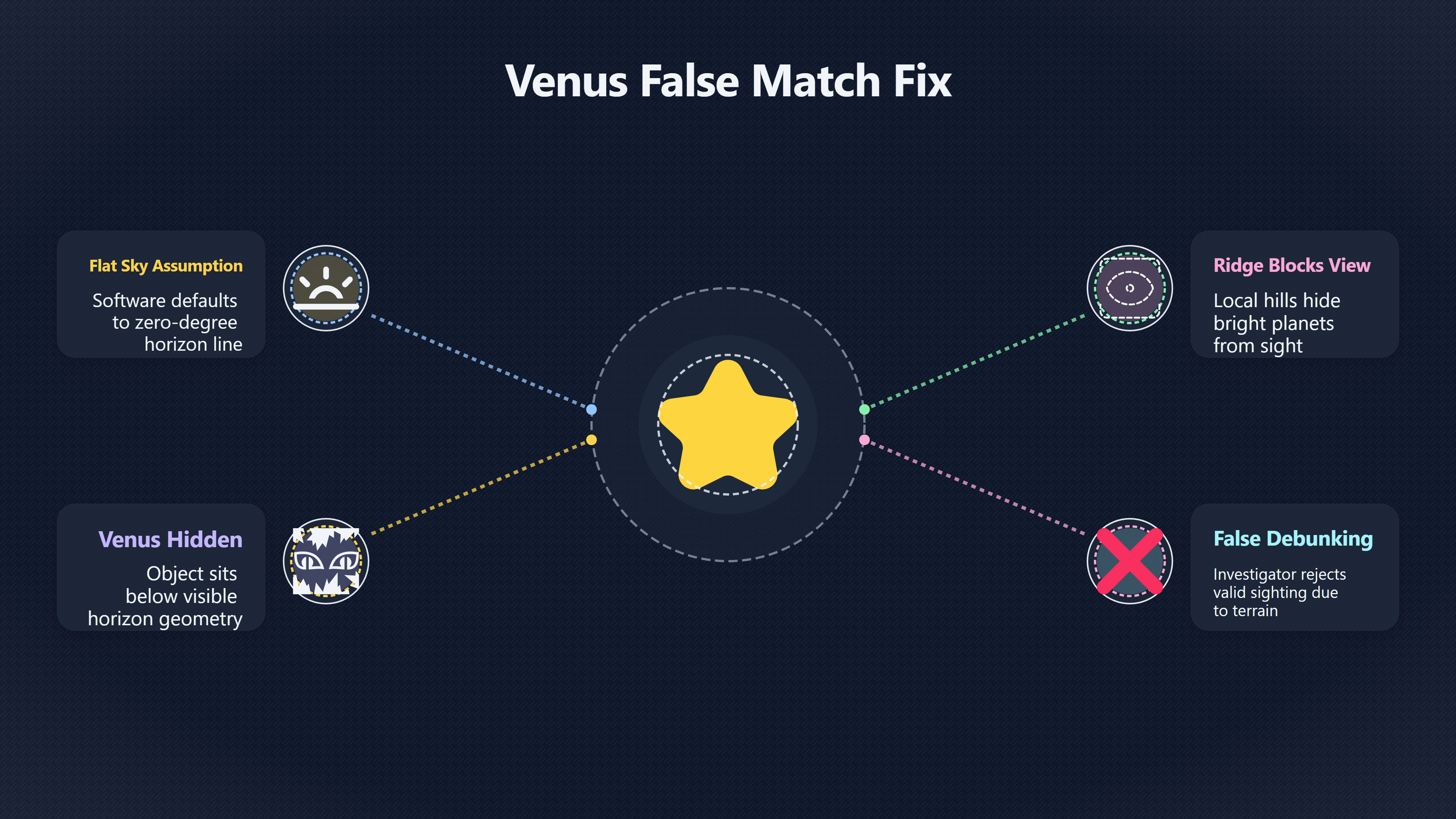
Why Flat Horizons Create False Matches
Many UFO astronomy checks fail because the investigator only verifies compass direction and clock time. That approach often produces misleading “matches” for bright planets low in the sky.
Venus is the classic example. It is extremely bright, often appears stationary to casual observers, and is commonly misidentified as a hovering object. But Venus also spends much of its visibility period very close to the horizon. In practical field conditions, a hill only a few degrees high can remove it from view long before it technically sets below the astronomical horizon.
The distinction matters because astronomy software usually defaults to an idealised horizon. The software may correctly show Venus at 3° altitude in the west, yet a witness standing behind a ridge or urban skyline may have had no possible view of it. The result is a false debunking: the reconstruction says Venus was present, but the real-world line of sight says otherwise.
The same problem affects:
- Moonrise and moonset identifications
- Bright aircraft lights near ridgelines
- Starlink trains close to the horizon
- Re-entry events seen from valleys
- Apparent “stationary lights” over coastal cliffs
- Claims that an object vanished behind hills
The visible horizon is not the same as the astronomical horizon. The visible horizon is shaped by terrain, buildings, vegetation and atmospheric conditions. [Wikipedia]WikipediaSource details in endnotes.
Even small elevation changes matter. A witness standing at street level in a dense city may lose several degrees of low-altitude sky behind buildings. Likewise, an observer in a Welsh valley or Scottish glen may not see the western sky until an object climbs well above the theoretical horizon.
This becomes especially important in reports where witnesses insist that an object “came from behind the hill”, “sat above the ridge”, or “dropped below the treeline”. Those statements can sometimes be tested quantitatively rather than treated as vague impressions.
How Terrain-Aware Horizon Modelling Works
A terrain-aware reconstruction combines astronomy with line-of-sight geography. The goal is to determine what sky was genuinely visible from the witness position.
The core workflow usually includes:
- Exact observer coordinates
- Observer height above ground
- Terrain elevation data [usgs.gov]usgs.govon dataset that merges trillions of lidar-derived terrain points…
- Direction and altitude calculations
- Time-synchronised astronomical positions
- Witness imagery or skyline references
The terrain component commonly comes from a Digital Elevation Model (DEM), which represents the Earth’s surface as a grid of elevation values. [USGS]usgs.govdigital elevation models terminology and definitionsDigital elevation models: Terminology and definitions8 Sept 2021 — Digital elevation models (DEMs) provide fundamental depictions of the… [USGS]usgs.govon dataset that merges trillions of lidar-derived terrain points…
An investigation system can then calculate the maximum terrain angle in every compass direction around the witness. Instead of assuming a perfectly flat 0° horizon, the software builds a custom skyline.
That skyline can then be compared against:
- Venus altitude
- Moon position
- Aircraft approach paths
- Satellite tracks
- Meteor trajectories
- Claimed UFO motion
In practical UFO casework, this often changes the interpretation dramatically.
For example:
ScenarioFlat-horizon conclusionTerrain-aware conclusionVenus at 2° altitudeVisible matchHidden behind ridgeMoon near moonsetWitness should see MoonBlocked by city skylineAircraft landing lightsToo low to observeVisible through valley openingSatellite flareHorizon-level visibilityObstructed by coastal cliff
The key point is that the witness did not observe an abstract sky sphere. They observed a specific slice of visible sky shaped by local geography.
Comparing Terrain Models With Witness Photos
Terrain-aware checks become far stronger when investigators compare calculated horizons against real photographs from the witness location.
A calibrated skyline image can anchor the reconstruction far more reliably than memory-based descriptions such as “just above the hill”.
The usual process is:
- Return to the observation point
- Capture a panoramic skyline image
- Match landmarks to compass bearings
- Align visible peaks or buildings with astronomical software
- Overlay object paths or celestial positions
This approach is especially valuable when witnesses photographed the object itself. Even blurry phone images often preserve important contextual information:
- Rooflines
- Ridge contours
- Tree silhouettes
- Streetlight positions
- Coastal edges
- Building spacing
These fixed features can be used to estimate the object’s angular altitude.
In many investigations, the horizon line itself becomes the most important evidence in the image.
A common mistake is to analyse only the luminous object while ignoring the skyline geometry around it. Yet the geometry may reveal that:
- the object was much lower than remembered
- the witness camera was tilted
- the apparent hover occurred above a ridgeline
- the “rapid descent” was simply movement behind terrain
Custom landscape imports in astronomy tools such as Stellarium are often used for this purpose. Investigators can build a witness-specific skyline panorama or terrain profile so that reconstructed celestial positions appear against the actual visible horizon rather than a generic flat one. [Stellarium]stellarium.orguser guide2021-03 v0.21.0: Accurate planet rotation (Libration, central meridians, subsolar points…) 2021-09 v0.21.2: Annual aberra… [GitHub]github.comGit Hubhorizon landscape with peakfinder or peakvisor?#3574Stellarium has no GIS capabilities and does not contain any database of terrestrial mountain peaks, so it's best to use software whi… [Stargazers Lounge]stargazerslounge.comStargazers LoungeTutorial: Custom Stellarium landscapesDec 19, 2010 — You need to add a new folder to the Program Files — Stellarium…
This becomes particularly important in long-duration UFO reports where witnesses insist that a bright object remained fixed relative to a hill, church tower or mountain notch. If the reconstructed Venus or Jupiter track follows the same apparent geometry over time, the identification strengthens considerably. If the terrain profile contradicts the witness view, the explanation weakens.
Testing Blocked Views Near Hills And Cities
Low-altitude sightings near hills are among the easiest cases to misinterpret without terrain modelling.
Suppose a witness reports:
- a bright orange light
- low in the western sky
- apparently stationary
- visible for 20 minutes
- then disappearing suddenly
A flat-sky reconstruction may show Venus fitting the azimuth and timing perfectly.
However, terrain analysis may reveal:
- a ridgeline at 4° altitude
- Venus already below 3°
- no physical line of sight from the witness position
That single terrain measurement can overturn the explanation entirely.
The reverse also happens. Witnesses sometimes insist that “there were no hills in the way”, but DEM-based skyline profiles show a shallow ridge precisely where the object vanished. In those cases, terrain modelling can support an ordinary explanation rather than weaken it.
Cities introduce different complications.
Urban horizons are highly irregular and often dynamic:
- tower blocks
- cranes
- rooftop structures
- elevated railways
- billboard lighting
- reflective glass surfaces
A bright planet viewed through gaps between buildings can appear intermittently, producing reports of lights “switching on and off” or “moving between structures”.
City light pollution also compresses perceived depth. Witnesses may struggle to distinguish whether an object sits above a nearby rooftop or far beyond the skyline.
In coastal cases, investigators must additionally account for:
- cliff elevations
- sea-horizon refraction
- observer height above water [ringbell.co.uk]ringbell.co.ukDistance to the Horizon CalculatorThis is a rough guide to determine the distance of the horizon based on the observer's height above mea…
- harbour lighting
- offshore platforms
At sea level, the visible horizon differs significantly from an inland ridge horizon. Atmospheric refraction can also slightly extend or distort apparent visibility near the horizon. [Wikipedia]WikipediaSource details in endnotes.

Why Witness Height And Camera Position Matter
A terrain-aware horizon is not fixed. Moving only a short distance can change visibility significantly.
Critical variables include:
- standing versus seated observer
- hillside roads
- apartment balconies
- bridge viewpoints
- elevated car parks
- drone footage
- upper-floor windows
Even a small height increase can expose a previously hidden celestial object. Distance-to-horizon calculations demonstrate how observer height changes visibility range. [Wikipedia]WikipediaSource details in endnotes. [2A Green Flash Page]aty.sdsu.eduA Green Flash PageDistance to the HorizonThe distance to the horizon in kilometers is about 3.86 km times the square root of the height i…
This matters in UFO investigations because witnesses often relocate during the sighting:
- walking outside
- driving uphill
- stopping on a lay-by
- climbing stairs
- filming from different positions
If the reconstruction assumes a single static viewpoint, the geometry may become inaccurate.
Careful case files therefore record:
- exact observation point
- whether the witness moved
- eye height estimate
- camera height estimate
- orientation changes during recording
Some advanced workflows even model the line of sight frame-by-frame across a moving route.
Common Failure Modes In Horizon Reconstruction
Terrain-aware analysis improves reliability, but it also introduces new ways to make mistakes.
DEM Resolution Problems
Low-resolution elevation models can smooth away small but important ridges. A broad regional DEM may miss:
- tree lines
- embankments
- local hill crests
- quarry edges
- seawalls
- urban structures
High-resolution lidar-derived terrain data usually performs better where available. [USGS]usgs.govThose are being systematically replaced with DEMs derived from high-resolution lidar and IfSAR (…Read more… [USGS]usgs.govLandsat Collection 2 Digital Elevation ModelThe DEM sources described below are used in Landsat Collection 2 data processing for all area…

Ignoring Buildings And Vegetation
Most DEMs represent bare earth rather than the real skyline. [USGS]usgs.govUSGSWhat is a digital elevation model (DEM)?A Digital Elevation Model (DEM) is a representation of the bare ground (bare earth) topograph…
That means the calculated horizon may still differ from reality in cities or forests. A witness may have lost visibility behind:
- tower blocks
- woodland
- industrial structures
- roadside trees
This is one reason calibrated photographs are often more valuable than terrain data alone.
Compass Misalignment
Witness bearings are frequently inaccurate.
People tend to overestimate precision when recalling direction, especially at night. A claimed “due west” sighting may actually fall anywhere from south-west to north-west.
A terrain-aware system only works if the azimuth alignment is credible.
Atmospheric Effects
Refraction near the horizon can slightly raise apparent object altitude. [Wikipedia]WikipediaSource details in endnotes.
Under unusual conditions, bright objects can appear distorted or temporarily visible beyond the expected geometric horizon. This does not usually invalidate terrain analysis, but it can complicate low-altitude edge cases near sea horizons or temperature inversions.
Why Horizon Checks Matter In AI-Assisted UFO Investigation
Terrain-aware horizons are valuable because they constrain speculation with geometry.
Without skyline analysis, almost any low-altitude UFO report can be loosely matched to a bright celestial object. With skyline analysis, the proposed explanation must satisfy stricter conditions:
- correct azimuth
- correct timing
- correct brightness
- correct altitude
- unobstructed line of sight
That makes the reconstruction more reproducible and more falsifiable.
For AI-assisted investigation systems, terrain modelling also improves automated triage. A workflow can quickly eliminate weak astronomy matches by checking whether the candidate object was actually above the local visible horizon at the reported time.
This prevents two opposite errors:
- forcing a mundane explanation where visibility was impossible
- treating an explainable sighting as anomalous because the reconstruction ignored terrain
In practical UFO case analysis, the skyline is often as important as the sky itself.
Endnotes
-
Source: Wikipedia
Link: https://en.wikipedia.org/wiki/Horizon -
Source: usgs.gov
Link: https://www.usgs.gov/faqs/what-a-digital-elevation-model-demSource snippet
USGSWhat is a digital elevation model (DEM)?A Digital Elevation Model (DEM) is a representation of the bare ground (bare earth) topograph...
-
Source: usgs.gov
Title: digital elevation models terminology and definitions
Link: https://www.usgs.gov/publications/digital-elevation-models-terminology-and-definitionsSource snippet
Digital elevation models: Terminology and definitions8 Sept 2021 — Digital elevation models (DEMs) provide fundamental depictions of the...
-
Source: github.com
Title: Git Hubhorizon landscape with peakfinder or peakvisor?
Link: https://github.com/Stellarium/stellarium/discussions/3574Source snippet
#3574Stellarium has no GIS capabilities and does not contain any database of terrestrial mountain peaks, so it's best to use software whi...
-
Source: stellarium.org
Link: https://stellarium.org/guide/Source snippet
user guide2021-03 v0.21.0: Accurate planet rotation (Libration, central meridians, subsolar points...) 2021-09 v0.21.2: Annual aberra...
-
Source: usgs.gov
Link: https://www.usgs.gov/3d-elevation-program/new-product-3d-elevation-program-seamless-1-meter-digital-elevation-model-s1mSource snippet
on dataset that merges trillions of lidar-derived terrain points...
-
Source: usgs.gov
Link: https://www.usgs.gov/faqs/what-types-elevation-datasets-are-available-what-formats-do-they-come-and-where-can-i-downloadSource snippet
Those are being systematically replaced with DEMs derived from high-resolution lidar and IfSAR (...Read more...
-
Source: usgs.gov
Link: https://www.usgs.gov/landsat-missions/landsat-collection-2-digital-elevation-modelSource snippet
Landsat Collection 2 Digital Elevation ModelThe DEM sources described below are used in Landsat Collection 2 data processing for all area...
-
Source: stellarium.org
Link: https://stellarium.org/files/guide.pdfSource snippet
Stellarium 26.1 User GuidePermission is granted to copy, distribute and/or modify this document under the terms of the GNU. Free Document...
-
Source: stellarium.org
Link: https://stellarium.org/doc/0.20/classLandscape.html -
Source: github.com
Link: https://github.com/chengxinlun/Stellarium-android/issues/11Source snippet
Possibility to add custom landscape based on horizon...7 May 2019 — Would you give the user to add his own landscape configuration as ho...
Published: May 2019
-
Source: youtube.com
Title: Your Own Landscape in Stellarium
Link: http://www.youtube.com/watch?v=ZmJ9m9fMVAkSource snippet
Stellarium with Sky Surveys: Astrophotography Game-Changer...
-
Source: youtube.com
Title: Stellarium with Sky Surveys: Astrophotography Game-Changer!
Link: http://www.youtube.com/watch?v=5ddQDw-COX4Source snippet
Using Stellarium to Explore the Sky...
-
Source: youtube.com
Title: Best App To Observe Planets, Satellites, Stars And Constellations
Link: http://www.youtube.com/watch?v=2NfZoxZmox0Source snippet
Stellarium celestial navigation...
-
Source: youtube.com
Title: Stellarium celestial navigation
Link: http://www.youtube.com/watch?v=Ea2ZKuGf-hESource snippet
How to use Stellarium horizon line for observation Stellarium with Sky Surveys: Astrophotography Game-Changer...
-
Source: stargazerslounge.com
Link: https://stargazerslounge.com/topic/83937-tutorial-custom-stellarium-landscapes/Source snippet
Stargazers LoungeTutorial: Custom Stellarium landscapesDec 19, 2010 — You need to add a new folder to the Program Files --- Stellarium...
-
Source: stargazerslounge.com
Title: 408222 how to create a bespoke stellarium landscape
Link: https://stargazerslounge.com/topic/408222-how-to-create-a-bespoke-stellarium-landscape/Source snippet
How to Create a Bespoke Stellarium Landscape24 Mar 2023 — The Stellarium User Manual gives some pointers to creating a bespoke landscape...
-
Source: kloppenborg.net
Title: stellarium fisheye landscape
Link: https://kloppenborg.net/blog/stellarium-fisheye-landscape/Source snippet
Create a fisheye horizon landscape for Stellarium3 Dec 2023 — In this blog post I explain how to use your mobile phone and some cross-pla...
-
Source: aty.sdsu.edu
Link: https://aty.sdsu.edu/explain/atmos_refr/horizon.htmlSource snippet
A Green Flash PageDistance to the HorizonThe distance to the horizon in kilometers is about 3.86 km times the square root of the height i...
-
Source: stargazerslounge.com
Title: Obstructed horizon
Link: https://stargazerslounge.com/topic/406254-obstructed-horizon/Source snippet
The Astro Lounge7 Feb 2023 — The higher you are and the further away from the obstruction you are the less it affects your view. In my ex...
-
Source: eoportal.org
Title: digital elevation models
Link: https://www.eoportal.org/other-space-activities/digital-elevation-modelsSource snippet
(DEMs)19 Sept 2025 — DEMs are commonly used to help correct distortions in satellite data products caused by terrain elevation in a proce...
-
Source: archeoastronomy.org
Link: https://www.archeoastronomy.org/assets/downloads/slides/ast/ast-12_seac2025-stellarium-landscape-course-notes.pdfSource snippet
Stellarium Panorama (Landscape) TutorialFirst, find a principal match of only the horizon row with as little error as possible...
-
Source: cloudynights.com
Link: https://www.cloudynights.com/forums/topic/947470-stellarium-mark-specific-altitude-line/Source snippet
Works with declinations as well. Perfect, that was exactly what I was looking for!Read more...
-
Source: cloudynights.com
Title: 859139 stellarium landscape image howto
Link: https://www.cloudynights.com/forums/topic/859139-stellarium-landscape-image-howto/Source snippet
Stellarium Landscape Image Howto14 Jan 2023 — 1.Use an iPhone mounted on a simple tripod · 2.Set it vertical and angled up about 20 degre...
-
Source: schoolofthefuture.eu
Title: Stellarium User Guide
Link: https://www.schoolofthefuture.eu/sites/default/files/stellarium_user_guide.pdfSource snippet
polygonal horizon line. Each. R,G,B component is a float within 0...Read more...
Additional References
-
Source: ringbell.co.uk
Link: https://www.ringbell.co.uk/info/hdist.htmSource snippet
Distance to the Horizon CalculatorThis is a rough guide to determine the distance of the horizon based on the observer's height above mea...
-
Source: physics.unlv.edu
Link: https://www.physics.unlv.edu/~jeffery/astro/celestial_sphere/horizon_types_formula.htmlSource snippet
UNLV Physicshorizon_types_formula.htmlThe visible horizon is the actual local line dividing Earth features and sky. The visible horizon i...
-
Source: support.simulationcurriculum.com
Link: https://support.simulationcurriculum.com/hc/en-us/community/posts/360043200193-How-To-Accurately-Include-A-Custom-Landscape-In-SkySafari-6-Pro-Answer-Read-OnSource snippet
To Accurately Include A Custom Landscape In...6 Apr 2020 — The vertical sweep of the image represents 180 degrees of altitude, from the...
-
Source: omnicalculator.com
Link: https://www.omnicalculator.com/physics/distance-to-horizon -
Source: youtube.com
Link: https://www.youtube.com/watch?v=wv_Fpvf06BwSource snippet
Creating a Custom Landscape for StellariumThis video is a tutorial that shows you how to make a custom landscape and install it into sola...
-
Source: up42.com
Title: everything you need to know about digital elevation models dem digital
Link: https://up42.com/blog/everything-you-need-to-know-about-digital-elevation-models-dem-digitalSource snippet
UP42 Official WebsiteEverything you need to know about Digital Elevation...12 Mar 2021 — A Digital Elevation Model, also known as a DEM...
-
Source: photoplanet360.fr
Title: creer ses paysages panoramiques pour stellarium
Link: https://photoplanet360.fr/2018/03/02/creer-ses-paysages-panoramiques-pour-stellarium/Source snippet
Créer ses paysages panoramiques pour Stellarium2 Mar 2018 — La configuration à réaliser pour intégrer le paysage est assez simple, il fau...
-
Source: facebook.com
Link: https://www.facebook.com/groups/1295673443855365/posts/5246310025458334/Source snippet
w I have provided a simple, straight forward perspective drawing...
-
Source: almanac.com
Title: What Can You See on the Horizon?
Link: https://www.almanac.com/what-can-you-see-horizon-and-how-far-itSource snippet
(And How Far Is It?)6 Oct 2025 — The horizon is that magical but invisible line that appears to separate our Earth from the sky. It's the...
-
Source: nightskymiddleton.uk
Link: https://nightskymiddleton.uk/2023/01/16/creating-a-custom-horizon-in-n-i-n-a-stellarium-and-sky-safari/Source snippet
Creating a custom horizon in N.I.N.A, Stellarium and Sky Safari16 Jan 2023 — In Sky Safari, in Settings – Horizon & Sky, select Show Hori...
Amazon book picks
Further Reading
Books and field guides related to Did The Real Horizon Hide The Suspected UFO Object?. Use these as the next step if you want deeper reading beyond the article.
eBay marketplace picks
Marketplace Samples
Example marketplace items related to this page. Use the search link to explore similar finds on eBay.
Topic Tree